RTK vs LiDAR vs Vision: The Ultimate Guide to Never Losing GPS Signal Again
By Alexandre

RTK vs LiDAR vs Vision: The Ultimate Guide to Never Losing GPS Signal Again
Automated green space maintenance is undergoing an unprecedented technological shift in 2026. The removal of the perimeter wire—once an obligatory hurdle and a source of recurring failures—has paved the way for navigation systems with sophistication worthy of the autonomous automotive industry.
However, replacing a physical constraint with invisible signals shifts the complexity to the choice of the technology itself. For complex, wooded, or urban terrains, acquiring a robot mower is no longer just a question of cutting surface or battery capacity. The real question lies in the onboard processor's ability to interpret its physical environment when primary cues disappear.
This exhaustive analysis decrypts the mechanisms of RTK, LiDAR, and AI Vision (vSLAM), identifying specific pain points related to signal loss and proposing strategic recommendations for dominating the smart gardening niche.
The Challenge of Complex Gardens: Physical Limits of Standard Navigation
The residential garden ecosystem is particularly hostile to navigation signals. Unlike vast open agricultural plots where satellite positioning excels, private terrains are dotted with dynamic and static obstacles that alter wave propagation.
The Canopy Masking Effect and L-Band Attenuation
The classic GNSS system (utilizing GPS, Galileo, GLONASS, and BeiDou constellations) uses L-band radio waves. These signals, emitted from space, are extremely weak when they arrive on Earth. When a garden has a high density of deciduous or evergreen trees, the "canopy" acts as an absorbing filter.
Leaves—especially when gorged with water after a downpour or covered in dew—absorb and diffract the radio signal. Under a hundred-year-old oak, a robot mower losing its direct line of sight with the sky will see its precision drop instantly from a margin of a few centimeters to an uncertainty radius of several meters, triggering the device's safety shutdown.
The Multipath Effect in Urban Environments
The second enemy of satellite navigation is the "multipath effect." In gardens bordered by large glass windows, verandas, metal fences, or high concrete walls, the satellite signal bounces off these reflective surfaces before reaching the robot's receiver.
The receiver calculates distance based on signal flight time; a reflected signal that has traveled a longer distance misleads the system. The robot then interprets its position as being shifted by several meters, triggering a "Virtual boundary exit" alert and immobilizing the unit.
Anatomy and Decryption of Positioning Technologies
Faced with these physical limits, robotic engineering offers three major paradigms—often used in isolation on entry-level models and fused on high-end equipment.
1. The RTK System (Real-Time Kinematic): Precision through Differential Correction
Real-time kinematic positioning (RTK) marked the first true "wire-free" revolution. It relies on comparing the phase of the carrier waves of the satellite signal between two receivers: a fixed base station (whose coordinates are known with absolute precision) and a mobile receiver onboard the robot.
The fixed base captures satellite signals, calculates the error induced by ionosphere and troposphere perturbations, and transmits an ultra-fast correction signal (often via LoRa radio waves) to the robot. The ideal investment for very large, open terrains relies on this technology.
2. 3D LiDAR: Independence through Laser Mapping
To compensate for satellite signal deficiencies, LiDAR (Light Detection and Ranging) technology is essential. This system emits infrared laser pulses and measures Time-of-Flight to create an ultra-dense 3D point cloud of the environment, without depending on any external signal.
The best choice for heavily wooded terrain

Dreame A1 Pro LiDAR 2026
Navigation LiDAR 3D précise au centimètre comme une voiture autonome. Cartographie ultra-rapide en 15 min.
Affiliate link. Same price for you.
The OmniSense 3D system of the Dreame A1 Pro completely bypasses GPS, allowing for the mapping of a complex terrain in just 15 minutes, while navigating serenely under the densest shade.
3. AI Vision (vSLAM): Dynamic Pixel Analysis
The vSLAM system (Visual Simultaneous Localization and Mapping) gives the robot true ocular perception. Using high-resolution cameras coupled with neural networks, the robot extracts visual landmarks from its environment to triangulate its position.
The supreme advantage of Vision lies in its semantic classification capability. Unlike LiDAR, which detects a physical obstacle without knowing its nature, Artificial Intelligence specifically identifies if it's a toy, a garden hose, or a pet, dynamically adapting its safety distance.
Sensor Fusion: The Ultimate Navigational Architecture
Technical analysis proves that no single sensor can solve 100% of the scenarios in a complex garden. The industry is therefore moving toward Sensor Fusion, unifying the strengths of each technology to compensate for their respective weaknesses.
The Tri-Fusion Ecosystem: Mammotion Supremacy
The Tri-Fusion system, introduced on the Mammotion range (specifically the Luba 2 series), simultaneously integrates LiDAR, RTK, and AI Vision. The onboard computing power allows for "Dynamic Sensor Switching":
- Open space: RTK drives for maximum efficiency.
- Under a massive oak: 3D LiDAR takes over to maintain millimeter-accurate mapping.
- Facing a moving object: AI Vision intervenes for intelligent avoidance.
C-PASS Integration (vSLAM + INS): RoboUP Resilience
The C-PASS system developed for the RoboUP T1200 Pro fuses RTK, vSLAM, and an Inertial Measurement Unit (INS). The INS, composed of accelerometers and gyroscopes, allows for dead reckoning navigation. During a total loss of external signals, the robot maintains perfectly parallel mowing lines.
Navigation Technologies Comparison
|  |  |  |  | |
|---|---|---|---|---|---|
| Max area | 2000 m² | 500 m² | 2000 m² | 5000 m² | 1200 m² |
| Max slope | 45% | 30% | 45% | 80% | 45% |
| Wire-free | |||||
| GPS / RTK | |||||
| Cut-to-Edge | |||||
| App control | |||||
| Check price | Check price | Check price | Check price | Check price |
Equipment Strategy and Targeted Recommendations
Equipment selection requires a perfect match with the site topology. The following models have been rigorously selected to address documented technological "pains."
The LiDAR Choice for Wooded Complexity
The Dreame A1 Pro is a mapping feat. Devoid of a remote antenna, its installation is limited to positioning the charging station. Its LiDAR sensor draws a multi-zone map in record time. It is the definitive solution against the canopy effect.
All-Wheel Drive for Rugged Topographies
The Mammotion Luba 2 AWD stands out thanks to its all-wheel drive (AWD). Capable of climbing extreme slopes (up to 80%), it combines mechanical robustness with sharp navigation intelligence.
Raw power for rugged estates
Mammotion LUBA 2 AWD 5000
La référence tout-terrain pour 5000m². 4 roues motrices, grimpe aux arbres (ou presque, 80% pente) et vision 3D.
Affiliate link. Same price for you.
Urban Excellence and Installation Simplicity
For a classic residential garden, the Segway Navimow i105E represents the expert entry-level. It stands out by integrating EFLS 2.0 and its 140° VisionFence camera.
The quality/price reference for urban gardens
Segway Navimow i105E
La révolution sans fil accessible. Navigation RTK+Vision pour une précision centimétrique sans câble périphérique.
Affiliate link. Same price for you.
Quad-Camera Innovation
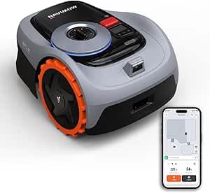
The approach of the Anthbot Genie 1000 is unique. By combining four cameras offering a 300° field of view with an RTK receiver analyzing 155 satellites, this robot guarantees flawless environmental safety.
Collection as a Bonus
The Mammotion YUKA deserves a special mention. It transcends simple mowing function thanks to its optional sweeper kit, capable of collecting dead leaves and plant debris.
Technical Guide to Installation and Optimization
Deploying an RTK solution requires scientific rigor to avoid positioning errors (multipath and masking).
- Horizon Assessment: The reference antenna must benefit from a clear visibility cone of at least 120 degrees toward the sky.
- Interference Avoidance: The antenna must be at least two meters away from metal walls, large glass windows, and reflective roofs.
- Elevation: Using extension kits to fix the antenna at the top of the roof is often essential to overcome the canopy effect.
- Signal Validation: A stabilized signal (often indicated in green or "Fix") must be maintained for at least 15 minutes before mapping.
Garden Smart Home: The Synergy between Mowing and Irrigation
Modern technological expertise no longer conceives of garden maintenance in silos. Integration via Home Assistant allows for true environmental intelligence.
Adaptive Automation Script (Home Assistant Example)
The following YAML script illustrates a preservation logic: it prohibits the deployment of the robot mower if the ground is too wet and only activates irrigation if precipitation is absent.
[BLOCK: Code language="yaml"] alias: "Adaptive Mowing and Irrigation Optimization" mode: single trigger:
- platform: time at: "06:00:00" condition: # Check soil moisture via Ecowitt probes
- condition: numeric_state entity_id: sensor.ecowitt_soil_moisture_1 below: 40 # Confirm absence of rain via Netatmo
- condition: state entity_id: binary_sensor.netatmo_rain_status state: "off" action: # Prohibit robot mower departure to avoid compaction
- service: vacuum.pause target: entity_id: vacuum.external_robot_mower # Targeted trigger of the Eve Aqua valve
- service: switch.turn_on target: entity_id: switch.eve_aqua_main_zone
- delay: minutes: 25
- service: switch.turn_off target: entity_id: switch.eve_aqua_main_zone # Resume mowing after a 2-hour drainage phase
- delay: hours: 2
- service: vacuum.start target: entity_id: vacuum.external_robot_mower [/BLOCK]
Preventive Maintenance and Sensor Longevity
The long-term reliability of fusion systems depends on meticulous maintenance. Sensing components (AI cameras, LiDAR domes) constitute the nervous system of these machines.
- Bi-monthly cleaning: Use a soft microfiber cloth and clear water for lenses and domes. Avoid abrasive detergents.
- Winter storage: Store the robot in a dry and temperate place to preserve the battery.
- Sharp blades: Replace blades every 8 weeks to minimize harmful vibrations to internal sensors (INS).
Frequently Asked Questions
Why is my RTK robot stopping under the trees?
Are LiDAR systems sensitive to rain?
Is it possible to map at night with AI cameras?
The landscape of green space maintenance has crossed a definitive threshold. Understanding the physical mechanisms that govern satellite waves, lasers, and pixel analysis allows for guidance toward resilient and high-performing solutions.
Not sure about the model?
Our simulator guides you in choosing between RTK, LiDAR, and Vision.
Read also

Apr 18, 2026
GPS Robot Mower vs. Wire: Which is the Best Choice?
Should you go wireless or stick with the cable? Complete analysis of costs, installation time, and actual return on investment.
.png&w=3840&q=75)
Apr 18, 2026
Why Your Robot Mower Misses Grass and How to Optimize Its Cut
No more unsightly grass tufts and uncut strips! Discover why your robot leaves marks and how to set up a cut worthy of a golf green.

Apr 18, 2026
What is the Best Robot Mower for Large Estates Over 4,000 m² (1 Acre)?
Comparisons often ignore vast properties. Discover our expert guide dedicated to robot mowers tailored for parks and estates from 1 to 2.5 hectares (1-6 acres).